
Projects
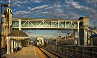
City of Buena Park
Buena Park, California
GDMS updated the current Intranet GIS system to new technology. We
assisted the City with the determination of specifications for a new GIS
server from Dell. Next, we developed a modern CityWide GIS interface
for Autodesk Infrastructure MapServer 2015 (AIMS). We added tools
for integration of Google StreetMap and Google address searching.
Then we created departmental applications for police, fire, planning,
traffic, and maintenance. The 2nd phase of the project will start this July
and includes functionality to provide field access and special
applications for field personnel.
.
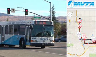
Antelope Valley Transportation Agency
Antelope Valley, California
Our services included providing GIS mapping and database development for 702 existing bus stops within the Antelope Valley portion of Los Angeles County. In the initial phase, each bus stop was located with GPS and inventory attributes were collected.
The locations and attributes were integrated into the automated transportation system to help track bus locations and to announce bus stop locations to riders on the bus.
Services Summary
- Asset Inventory
- Web based applications
- Emergency response
- Graffiti tracking
- Customer complaint tracking
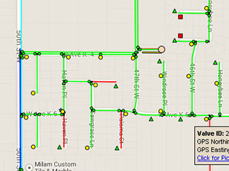
Quartz Hill Water District
Quartz Hill, California | 5,000 acre service area
Our services included database development for water mains, valves, hydrants, and other appurtenances for the QHWD 5,000 acre service area. Mapping has been developed using field GPS observations, as-built drawings and county parcel data. For the final product we developed a map book system for all the facilities for use in the field.
Services Summary
- Asset inventory (GPS)
- Web based applications
- iPAD setup for field staff
- Map book development
- As-built surveying
Ojai Valley Sanitary District
Ojai, California
GDMS has provided GPS/GIS asset development and mapping services for the Ojai Valley Sanitary District. We continuously maintain the sanitary sewer system and update with new mainlines, reference layers, and as-built information. Our early focus was to increase the accuracy of locations and system attributes utilizing the latest as-built drawings for manholes and mainlines. We have field captured GPS locations of some facilities to check the integrity of manhole locations. The initial GIS system was prepared by a previous consultant in ArcView and MapGuide. We implemented a modern and fully customized Autodesk Infrastructure Map Server intranet application to deliver data and tools to staff. Other services include maintaining a district wide map book in ArcGIS, updating district boundaries, annexations, and development of voting districts. Updated districts were developed based on the latest demographic information for population where each district was balanced to ensure each representative had an equal numbers of constituents.
Services Summary
- Web based GIS
- GIS Data Management
- Map Book Services
- Mapping Services
- Voting Boundaries
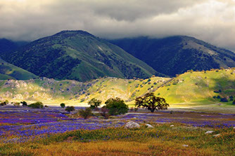
Tejon Ranch
Tejon Ranch, California | 422 square miles / 270,000 acres
GIS data development for Tejon Ranch boundaries: The ultimate goal of this project is to obtain an accurate and complete a boundary of the Tejon Ranch property within Kern County from existing record documents and GPS surveying. Results were provided the Kern County Assessor and were used in the Tejon Ranch GIS system.
Services Summary
- Research existing recorded documents
- Review, analyze and calculate all boundary maps
- Draw ranch boundary using existing mapping and legal documents
- Set permanent survey monuments as required
- Develop both CAD and GIS formatted data
GDMS | 42140 10th Street West, Lancaster, CA 93534 | Phone: (661) 949-1025 | gdms@gdms-1.com